Govt, tour operators fight over Nwoya land
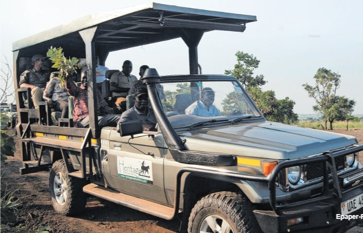
A tourist van transports guests through a private wildlife conservancy established inside the contested area. PHOTO/ TOBBIAS JOLLY OWINY
What you need to know:
- While the government is determined to retain control of strategic land for agriculture, the safari lodge operators fear losing their investments in the tourism sector
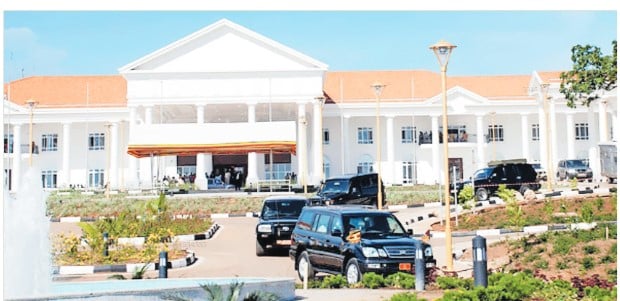
At least 13 safari lodges and hundreds of families could be severely affected should the government reclaim a 10 square miles piece of land in Purongo Sub-county, Nwoya District.
Wrangles the Nwoya District Land Board over the piece of land have sucked in a string of lodges, including Tilenga Safari Lodge, Heritage Safari Lodge, Vilakazi Safari Lodge, Ikorom, Wild Palace, Parkside, Nile Breeze, Barlyec, Bwana Tembo, Nature Lodge, Shoebill, Tango, and Mukuli Safari Lodges. Daily Monitor has established that the Lands ministry, jointly with the Uganda Land Commission (ULC) are scheduled to begin the boundary opening of the land and demarcate the boundaries this month.
In an August 26, 2024 memo to Lands minister Judith Nabakooba, Dorcas Okalany, the Permanent Secretary (PS) of the Lands ministry, maintained that the land belonged to ULC. PS Okalany also told Minister Nabakooba that issues surrounding the contested land had been raised before Parliament. The Works ministry PS was reacting to an earlier petition to Parliament in mid-July by Judith Peace Achan, the Nwoya District Woman Representative in the House, who sought government intervention and initiation of a boundary opening over the contested land between the community of Tee Okot Village and the Ministry of Agriculture, Animal Industry and Fisheries (Maaif).


The land under contention was acquired by President Idi Amin's government and used by Maaif before being handed to the Palestinian Liberation Organisation fighters. After some time, the fighters abandoned the land. The Land ministry claims that upon abandonment, the land reverted to Maaif, with the ministry going on to set up an animal quarantine area.
Standoff
In an August 29 response to Parliament, Kania Obiga, the junior Lands minister, emphasised that the contested land belonged to the government. He also hastened to add that the Nwoya District Land Board irregularly allocated the land to individuals.
“The government owns 10 square miles of land at Teo Okot and the land is under use by the Ministry of Agriculture, Animal Industry and Fisheries,” Minister Obiga wrote, adding, “As long as land was set aside for the government or any other public body whether titled or not, it is still government land and has never reverted to the people.”
The Nwoya District Land Board has over time irregularly allocated this land to different people. These allocations are now being reviewed by ULC and its line ministry.
“Government land may either be surveyed and titled or gazetted and not titled or not gazetted and not titled. Government, therefore, need not have a certificate of title to prove ownership of land that falls in the above categories, Minister Obiga stated.
Monitor has seen a February 14 letter in which Peace Diana Acayo, the Secretary of the Nwoya District Land Board, wrote to the Lands ministry’s zonal office in Gulu City to clarify the status of the contested land. This followed a move by the ministry to cancel the survey of plots 134 and 137 Block 4 at Pacubu, Purongo Sub-county. The two plots (134 and 137) were in 2013 leased by Amuru District Land Board to Odoch Bosco Olak under LAF: AMURU/LAN/305, Minute ADLB(10) Min 4(b)(15) of May 30, 2013 and were successfully surveyed under instruction No. J/01/0614.
We understand that Mr Odoch has engaged in transactions with various individuals involving the said plots. Consequently, he has transferred part of his interest to these individuals, who have their respective portions of the land. The individuals have also successfully submitted applications to the district land board of Nwoya.
Differences
In the letter, Ms Acayo differed from Mr Obiga’s position that the government owned up to 10 square miles in the area. She also disputed claims that the government directed that one square mile be reserved for Maaif, with the rest of the finite resources leased out.
“What was directed to be leased to Amida Investment Ltd was nine square miles and only one square mile was to be reserved for MAAIF,” Ms Acayo revealed, adding, “The one square mile, in this case, is to the eastern side of land leased out to Amida Investment.”
According to her, the land to the western boundary of Amida Investment Ltd does not belong to the government based on the directive.
“This is why the District Land Board has consistently only sanctioned transactions to the western boundary of Plot 56 Block 4 and not sanctioned any transaction on approximately 1 square mile to the Eastern boundary to Plot 56 Block 4,” she reasoned.
Regardless, the individual applicants are currently in physical possession of their respective portions of land. They have, she added, significantly developed them after running them by the approved physical development plan and land use planning for the area, she added.
Acting on a recommendation from the Prime Minister after consultations with Maaif on March 17, 2006, ULC allocated nine square miles of land at Gotapwoyo. The land in question was once upon a time used as a government ranch by M/s Amida Investments Ltd. In 2008, Maaif advised that the acreage be reduced to five square miles.
On August 28, 2008, Paul Idude, then Secretary of ULC, wrote to the Commissioner of Surveys and Mapping directing the survey of the five square miles of land. “It is in this regard that I request you to authorise a private survey firm to carry out the survey works for the five square miles and thereafter forward the corresponding set of certified deed plans.”
Maaif had in 2008 advised that the land be allocated to Amida Investments Ltd owned by Dr Kenneth Lapenga. Whereas it wanted the land to be reduced to five square miles, Dr Lapenga was pushing for six square miles. Eventually, five square miles were surveyed, and a leasehold title of Purongo Block 4 Plot 56 was registered, leaving a residue of five square miles.
Implications
The sanctioning of transactions on the estate by the Nwoya District Land Board has resulted in various plots which have been registered in the National Land Information System, including Purongo Block 4 Plots 127, 128, 130, 131, 136, 137, 257, 258, 259, 260 and 275. The one square mile that the district claims to belong to the government lies to the East of Purongo Block 4 Plot 56. Some plots are registered in the National Land Information System (Purongo Block 4 plots 143 and 175).
We have seen a copy of the documentary review and analysis of the contested land conducted by the ULC. The document in question revealed that while Nwoya District allocated land to individuals, it was oblivious to the fact that the land allocated to Amida Investments Ltd was reduced to five square miles from the initial nine square miles that had been sanctioned.
“Because of that, the Nwoya District Land Board has been inclined to conclude that Uganda Land Commission has only one square mile left, with Amida covering nine square miles, leaving the rest of the government land at Gotapwoyo at its disposal. However, this isn't the case,” the documentary review reads in part.
“The land to the Western Boundary of Purongo Block 4 Plot 56 is part of the five square mile residue from the subdivision survey that created the leasehold title for Amida Investments Ltd. This land is under the mandate of the ULC and surveys over it should not be sanctioned by Nwoya District Land Board,” Mr Arthur Akanga, a surveyor with ULC, stated in the June 24 report.
On April 3, 2024, ULC wrote to the Senior Staff Surveyor, Lands Ministry Zonal Office in Gulu asking for the erasure of survey records of Plot 134 and 137 Block 4 at Pacabu, Purongo Sub-county. It also wanted 40 hectares to be carved out of the land for lease to a new developer.
“This is to notify you and further reiterate our request to you to erase the survey for Plots 134 & 137 and, thereafter, carry out a new survey on the land to carve out 40 hectares of land for lease to Three Ways Shipping Group Limited,” ULC said.
The letter also made clear that the District Land Board has no jurisdiction over the land and thus declared any transactions by the Board on the same as null and void.

Lands minister Judith Nabakooba
“Any surveys caused by the District Land Board should be erased. We would like to clarify that the land is part of the 10 square miles gazetted as a Quarantine Area under use by the Ministry of Agriculture, Animal Industry and Fisheries,” the letter further reads. “The Commission has repeatedly communicated requesting your office to cancel surveys done on the above-captioned land and to conduct fresh surveys to carve out 40 hectares for lease to M/s Three Ways Shipping Services Group Ltd.”
Court ruling
In April 2007, in a ministerial statement on land issues in the Acholi Sub-region and other related land matters, then Lands minister Omara Atubo told the House that the contested land belonged to the government (Maaif).
“Got Apwoyo Ranch land belongs to the government. It falls under the category of government land which is gazetted but not titled. It is for the Ministry of Agriculture, Animal Industry and Fisheries and is used as an animal holding and quarantine ground,” Mr Omara stated. “Government may therefore at its discretion following policy and guidelines, deal in its land in the way it deems fit, after consultations and approval from the user Ministry.”
A February 2023 ruling by the Constitutional Court, however, ordered district land boards to keep off de-gazetted lands. The court ruled that leasing de-gazetted land and former public land by the district land boards was unconstitutional. This followed a 2019 constitutional petition in which Rtd Justice Galdino Okello Moro and others challenged the constitutionality of district land boards in the Acholi Sub-region in administering de-gazetted land and former public land (under the Public Land Act 1969) in Acholi Sub-region, which land has been held under customary tenure since 1995.
In a unanimous decision, the five judges held that de-gazetted land, which used to be owned by any customary owners, clan or community in Acholi Sub-region, reverts to the original customary owners under the Customary Tenure System where such ownership is proved.
Dr William Olwoch-Lalobo, the proprietor of Heritage Safari Lodge, one of the affected tourism facilities on the contested land, blames the conflict on the land tenure system.
“If the government de-gazetted it, and says we are no longer interested in it, it cannot continue to own it, it is double standards. What the government divested itself from, another government entity is claiming it, and some issues come with it, what was the term under which Maaif was given the land?” Dr Lalobo asked.
While he questioned the absence of documented evidence that a survey was done to determine (Deed Plan) the boundaries of the 10 square miles, Dr Lalobo says that an escalation of the conflict could negatively impact tourism in the area and the greater Murchison Falls National Park. “The land was leased to many of us after heeding the same government’s call to invest in tourism infrastructure to promote it and we have sunk in a lot of money and now actively contribute to the GDP of this country and you think this contribution is insignificant and should be nullified, where is the balance of equity and justice here?”
Legal ping-pong
Mr Kenneth Oketa, the chairperson Nwoya District Land Board, declined to give details about the matter. He said some of the landowners to whom the district leased out the land had already filed a suit in court and therefore any discussions on the same would fall afoul of the sub judice rule. He, however, said they had earlier written back to the Lands ministry to explain the circumstances under which they leased the land to individuals.
“We replied to them (ministry) in writing, [explaining] why we gave that land. After the de-gazetment, the ownership has never been clear, no activity was taking place there and it was like a sort of no man’s land.” Mr Oketta stated.
When contacted over the matter, Minister Obiga referred Saturday Monitor to his counterpart, Sam Mayanja whom he said directly handles land matters. Minister Mayanja was not readily available by press time.
On Thursday, we spoke to Tonny Kitara of Kitara & Co Advocates, a legal counsel of six of the affected developers including Fred Odoki, Jojinah Okello, Samuel Okello, Christine Lanyero Awany and others. He explained that they are still waiting for a formal response from ULC and the Attorney General after serving them notices before initiating legal action.
“My clients are in actual possession of the land and have since built safari lodges, camps, residential camps, a fuel station, etc. The said land forms part of the de-gazetted Aswa-Lolim Game Reserve, which the court made a clear ruling about its status recently,” Mr Kitara said.
“We are waiting for their response until next week, the court ruled that, upon gazettement, the ownership of the land reverted to the original customary owners and not the Uganda Land Commission,” he added.
Painful
In 2016, Kenneth Oketta Wilobo started to establish the Vilakazi Safari Lodge after securing 40 acres of land inside the disputed estate. To date, he has also established a zoo on the same land. He told Saturday Monitor that wrangling with developers who are investing in the tourism industry (a much-prized sector of the government), shows the disconnect in the operations of government ministries and departments.
“I have decided to create a small zoo near the park, and where do I take the animals? Tourism in Uganda is not like in Serengeti or Masai-Mara in Tanzania where you can recover your investment in a very short time. It is a process that takes time,” he said.
On July 14, 2022, President Museveni directed the Office of the Prime Minister and the Finance ministry to provide all that was required to kick-start the strategic interventions by the government to boost large-scale food production.
Mr Museveni’s directive was followed by an August 1, 2022 cabinet sitting at State House Entebbe in which it adopted a paper on strategic interventions to boost food and animal feed security in the country presented by the Agriculture ministry. The cabinet also agreed to support the proposed interventions of partnering with large-scale commercial farmers/farming entities for mass production of strategic commodities to guarantee food and animal feed security.
According to the deal, Uganda Prisons got 50,000 acres. Other beneficiaries included the Uganda Peoples’ Defence Forces (10,000 acres), the National Enterprise Corporation (5,280 acres), veterans (4,707 acres), the National Agricultural Research Organisation (10,000 acres) as well as the National Animal Genetic Resources Centre and Data Bank or NAGRC & DB (30,000 acres). Elsewhere, private large-scale farmers got a combined 314,000 acres.
To this effect, in Te-Okot Village, Got Apwoyo Sub-county, Nwoya District, NAGRC & DB have started clearing and planting on five square miles part of the disputed land, sparking contestation from land owners and especially members of the Ariya Clan, who claim ownership.
In August 2022, the Justice and Peace Commission (JPC) of the Gulu Archdiocese published a report detailing the impact of the intervention, including forceful evictions, displacement, and loss of lives.
“Foreign and local investors are beginning to invest heavily in large-scale agriculture, accompanied by numerous land conflicts between them and local communities. Amuru, Nwoya, and Lamwo are some of the centres of this conflict over large-scale investors,” the JPC report stated in part.