Mt Wati: West Nile’s hidden tourism gem
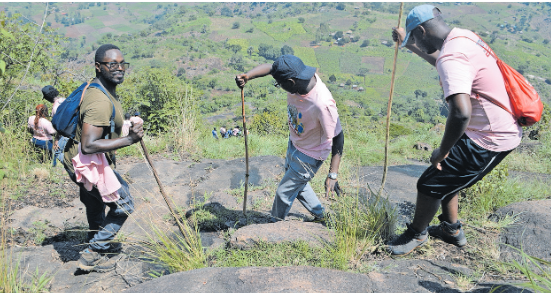
A group of hikers at the top of Mt Wati in Terego District in West Nile. PHOTO | CLEMENT ALUMA
What you need to know:
- With proper infrastructure and investment, the mountain could become a major attraction in the West Nile region, offering both natural beauty and a window into the area’s cultural heritage.
Climbing Mt Wati, a mountain in West Nile, Terego District, is a challenge not for the faint-hearted. Hikers must prepare for a demanding journey, as once you embark on the climb, help is scarce.
Proper hiking boots, trekking poles, snacks, a backpack, and ample water are essential, as dehydration is a likely companion.
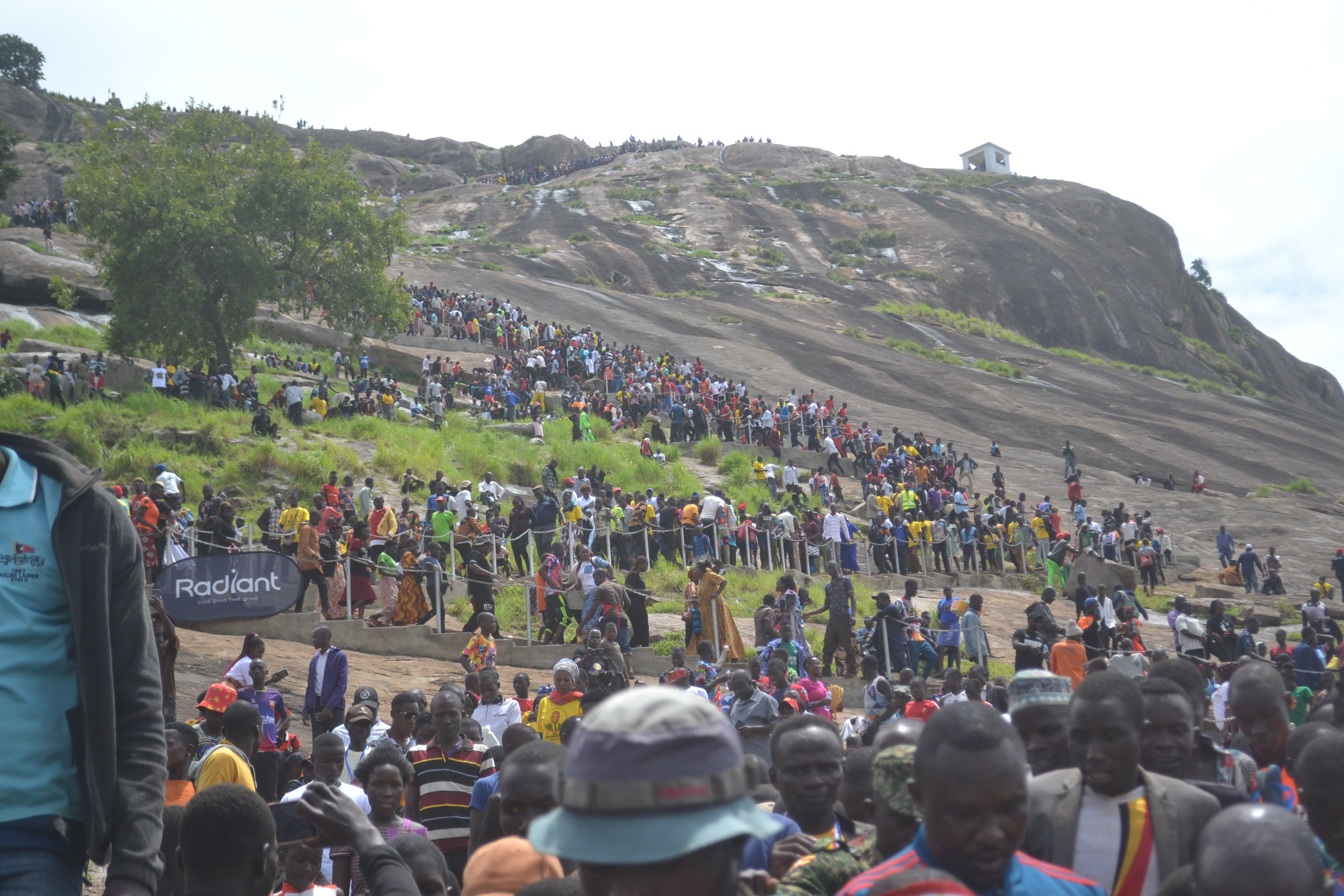
Rising approximately 1,250 metres above sea level, Mt Wati is believed to be the highest point in West Nile and is central to the ancestry of the Lugbara people. Located in Erea Parish, Aii-vu Sub-county, the mountain has only recently seen an influx of local tourists.

Hikers are rewarded with stunning views of several parts of West Nile, including Maracha, Koboko, and Arua districts.
The Terego District Tourism Officer, Mr Boniface Aniku, says while Mt Wati holds potential as a tourism destination, the area remains underdeveloped.
“We cannot close the place for tourists just because it has not been developed. We welcome private sector partnerships to help us realise this vision,” Aniku says, noting that the district lacks the financial resources to fully tap into Mt Wati's potential for generating revenue.
Plans to develop the site include constructing staircases for hikers, preserving the tomb of Banyale, the great-grandfather of the Lugbara, and establishing recreational facilities.
However, for now, the district is relying on private investments to bring these projects to life.
Ms Loyce Adiru, a resident, says: “This is a hidden treasure that needs to be exploited. If recreational facilities are created and roads graded, it could attract both tourists and locals. Businesses could flourish here.”
She, however, also expresses concern over environmental degradation due to the absence of regulation.
“Locals are cutting down trees, and this could cause landslides if the area is not protected,” Ms Adiru says.
Former Arua District chairperson and West Nile’s Tourism Ambassador Richard Andama Ferua says Mt Wati lacks the necessary infrastructure to support tourism.
“There are no sanitary facilities along the hiking trails, no accessible roads to the summit, no restaurants or accommodation for visitors, and no health or emergency services,” Ferua explains.
He adds that Terego District is currently constructing a health centre near the mountain, to serve both hikers and the local community.
Ferua also notes that because Mt Wati is part of a forest reserve under the National Forestry Authority, its development will require collaboration between the authority and other stakeholders.
About Mt Wati
Mt Wati is a sacred site in Lugbara tradition, believed to be the place where the first Lugbara ancestors settled. The mountain is also the gravesite of Oli Banyale and his wife, Ofunaru, prominent figures in Lugbara ancestry.
Historically, Mt Wati was a hideout for slave traders. The mountain also provided refuge for rebels who monitored government troops from its heights.
During the colonial period, under the Anglo-Egyptian Sudan administration, Mt Wati served as a landmark for explorers travelling from Egypt through the River Nile to Juba. The area was initially known as Jebel Wati, a name given by explorers, but in 1914, Everlyn Weatherhead, the first district commissioner of West Nile, changed the name to the West Nile after consulting local tribes.