Prime
Koboko’s fig tree which unites three countries
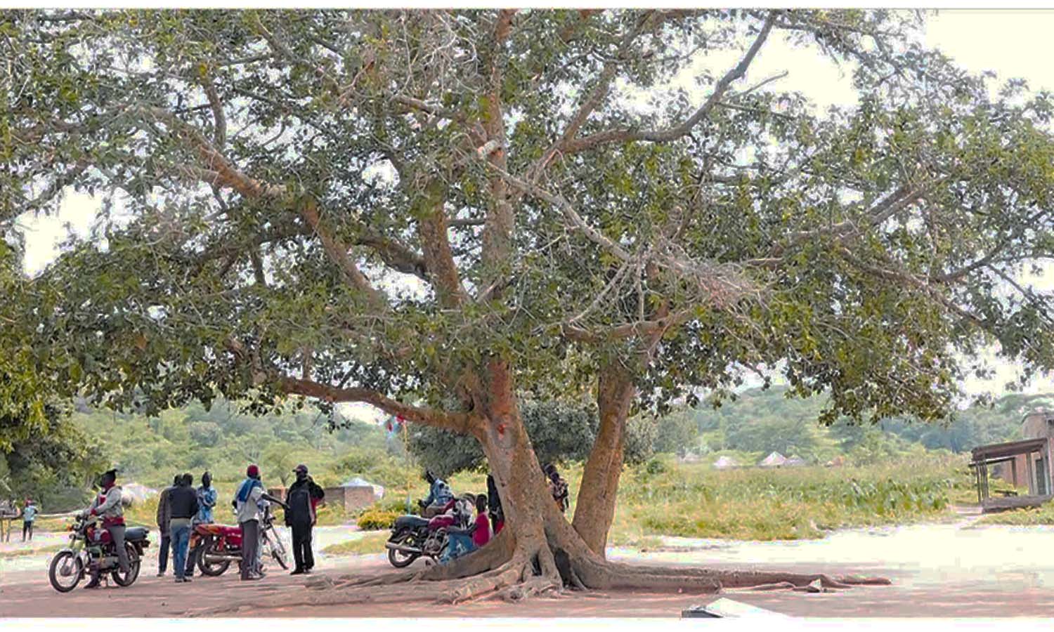
Motorists and residents sit under the fig tree that is the tourist attraction point-Salia Musala in Koboko District. PHOTO/RASHUL ADIDI
What you need to know:
- Elders say 60 percent of the tree trunk is in DR Congo, 30 percent is in South Sudan and 10 percent is in Uganda.
The name ‘Salia Musala’ holds significance among the Kakwa who live in parts of West Nile in Uganda, the Democratic Republic of the Congo, and South Sudan.
‘Salia’ means cooking stones while ‘Musala’ means three. Salia Musala, therefore, means three stones used to support an outdoor fire stove.
According to residents of Koboko, the colonialists had placed three stones in the shape of a traditional African home to depict the point in the district where the three countries of Uganda, DR Congo and South Sudan meet.
The stones are invisible now and at the point stands a fig tree, which residents say is about 80 years old.
The residents say the tree is a testament to the bonds shared by the people in the border areas of the three countries, who share the same cultural back-ground.
It is common for locals and tourists to visit and sit in the shade of the fig tree.
Lt Col Majid Ali Araba, 70, an elder, says the tree is the only triangular spot that unites people from the three countries who speak the same Kakwa language.
“It has some unique features where the dissection of the border is a tree that was naturally put there by God, with all its branches in these countries. The trunks are symbolic depending on the sizes of the countries. For example, the biggest trunk is in Congo, which is the largest country among the three,” he says.
He, however, says the point where the tree stands has in the past been politically contested by the three states.
“The rebel groups of the different countries used to get stationed at this point because it was easy to launch an attack on one country and run to the other as a fall-back position. With the stability in Uganda and establishment of detaches, we have stabilised Salia Musala through the local administration,” Lt Col Araba explains.
However, Mr Swali Ibrahim Asuman, another elder, argues that the tree is not the real Salia Musala and border meeting point but the three stones, which are on top of the adjacent Adi Hills.
He, however, says the tree stands at the place where the three chiefs of Uganda, Congo and South Sudan used to hold their meetings and conduct traditional courts.
Elders say 60 percent of the tree trunk is in DR Congo, 30 percent is in South Sudan and 10 percent is in Uganda.
This, they say, is line with the geographical sizes of the three countries. However, area residents say the site’ tourism potential has not been fully utilised despite receiving many visitors.
The place does not have proper toilets, and no clean and safe drinking water except one borehole. The locals share the water with animals from River Kaya that runs from South Sudan.
The children in the area go to Mena Primary School, about three kilometres away on the Ugandan side.
The nearest health facilities are Oraba Health Centre II and Keri Health Centre II, which are five and six kilometres away, respectively.
Ms Zainab Likicho, a resident, says I would be beneficial if the tree’s tourism potential is exploited.
“We share social services with people in those countries. There is no medical facility, it is hard for us when pregnant. If the three governments can unite and provide for us social services, it would be the best thing,” she says.
The harmonious coexistence among the people across the borders in the area is unprecedented. For instance, one does not need permission from anyone to cross over to the other side of the border.
The district tourism officer,Mr Derrick Tumusiime, says they have allocated Shs6 million to start developing the site.
“Tourism has been low in the district. We need to popularise and market the sites. In the last financial year (2023/2024), tourism was the least funded with a budget of Shs3 million. This money cannot do anything tangible,” he says.
He adds that there is some hope because, in this financial year, the Ministry of Tourism gave the district Shs10 million. State Minister for Finance-in-charge of Investment and Privatisation, Ms Evelyn Anite, says West Nile’s tourism is one of the major sectors the government is looking to develop.
“West Nile is the true definition of the pearl of Africa. It is a gold that the country hasn’t been talking about because of its sites. A place where you can enter three countries of DRC, South Sudan and Uganda at the same time,” she says.
The Tourism Development Officer in the Ministry of Tourism, Ms Esther Linda Nakami, who visited the site recently, said: "This particular visit has been eye-opening because some of the sites were not known to some of us. But we have actually realised that the region is rich in both natural and cultural heritage. We would take it up and see how far we can develop some of these sites.”
An appeal
The government needs to grade the roads and bring the ministry of Tourism in collaboration with the neighbouring states to put either a pyramid or triangle hotel where it touches all these countries. They can also construct a school that can teach French, English and Arabic– Mr Swali Ibrahim Asuman, an elder in Koboko District Lt Col Araba says the area has a poor road network, no electricity connection, no good hotels and other social amenities.
Mr Asumani believes that once the site is developed, current and future generations will benefit.
“The government needs to grade the roads and bring the ministry of Tourism in collaboration with the neighbouring states to put either a pyramid or triangle hotel where it touches all these countries. They can also construct a school that can teach French, English and Arabic,” he says.
Mr Ashirafu Jidu, a resident, says though tourists always visit the area, it has remained undeveloped.
“We do not have clean water and even a health centre. One has to walk 8km to Keri or Oraba Health Centre, about 5km.
A fig tree
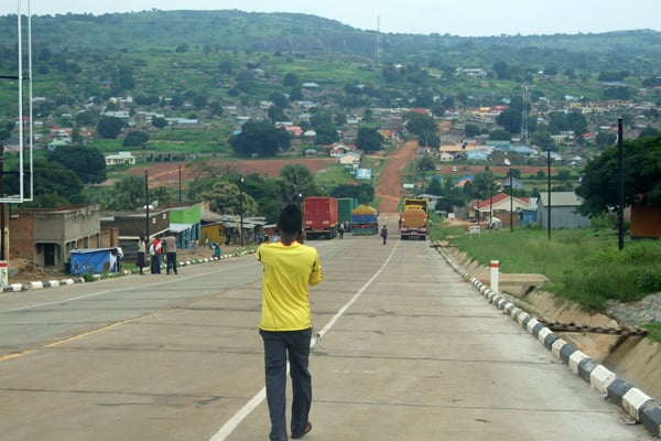
Koboko borders South Sudan in the north, DRC in the west, Yumbe District in the east, and Maracha District in the south. Koboko Town is located 3km from the DRC border and 18km from the South Sudan border (Oraba).
According to residents of Koboko, colonialists placed three stones in the shape of a traditional African home to depict the point in the district where the three countries of Uganda, DR Congo and South Sudan meet.
The stones are invisible now and at the point stands a fig tree, which residents say is about 80 years old.
The residents say the tree is a testament to the bonds shared by the people in the border areas of the three countries, who share the same cultural background.
