Ubos goes digital in census

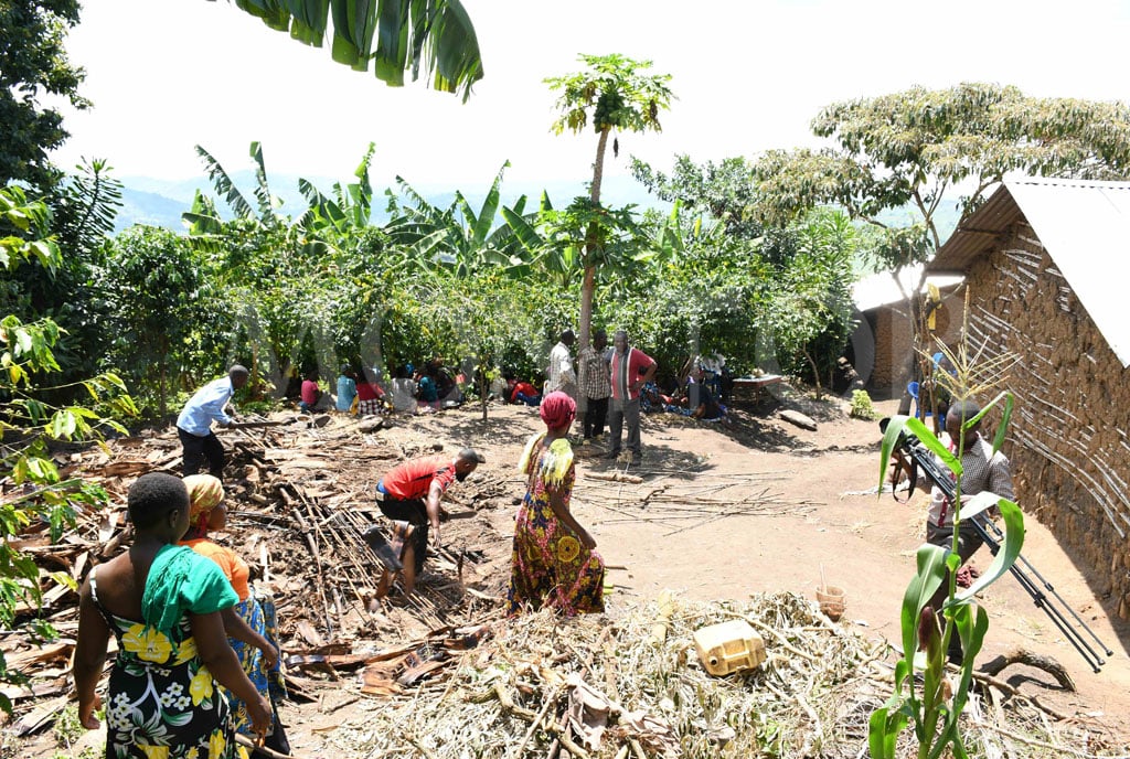
A census enumerator records data from a family in Kampala during the national housing and population census in 2014. PHOTO/FILE
What you need to know:
- During the supervision exercise on mapping in Oyam District, the Executive Director of Ubos, Mr Chris Mukiza, at weekend said the initiative has enabled easy identification of the households and their distance from social infrastructure.
The Uganda Bureau of Statistics (Ubos) is using Global Positioning System (GPS) and electronic tablets in the mapping exercise to avoid manipulation of data and ensure that their staff cover all households.
During the supervision exercise on mapping in Oyam District, the Executive Director of Ubos, Mr Chris Mukiza, at weekend said the initiative has enabled easy identification of the households and their distance from social infrastructure.
“The digital monitoring system will ensure that every place has been captured. We are also capturing the amenities, the social infrastructure, which are servicing the village. The nature of the road, if it is tarmac, the GPS will be there, it will be seen. If it is murrum, if there is a water point, we capture it so that we know how far or how long it takes to reach the water source. How far does the household take to reach the health service,” Mr Mukiza said.
The mapping exercise precedes the census, and also captures statistical data of households, their access to social amenities, such as schools, water, health centres, establish boundaries and infrastructure.
The mapping exercise, which started in October 2022, is expected to end in October.
Mr Mukiza said they have covered more than 65 percent of the country and are remaining with cities and 31 districts.
He said the initiative would also solve manipulation of data at the lower level, like at the district, with the purpose of gaining advance in terms of funding.
In previous censuses, certain local government authorities have been observed inflating population numbers and exaggerating the size of their areas.
This practice is often employed in districts with larger populations and social infrastructure challenges, as they are allocated more resources in the budget.
Mr Mukiza said using the digital system, every information at the household level is immediately sent to the centre and also shared with local authorities.
“After the digital mapping, we, at the centre and district leaders, will be able to see and monitor the collection of the data in real time during the census,” he said, adding that for each household covered, green would reflect on their screens.
“This exercise is important because it will provide information that will impact on the power planning and service delivery of every member of the household. And as we told you, it will also be used to inform the (Parish Development Model) PDM activities. The data we shall collect will be shared with the local governments to enable them to plan,” he said.
He added that they were using the digital mapping to calculate the logistical requirements that will be needed during the census.
District leaders in Bunyoro, Lango and Acholi regions told the Ubos supervising team that the local governments have carved out new lower level administrative units that need to be factored in the mapping and census exercise.
Mr John Mark Ogong, the Oyam District planner, said they have covered all areas, but data collectors were using the old list of villages yet there are new villages. “Allocation of government resources is based on data and it would be a disservice to the population of Oyam if we don’t do a comprehensive listing of the households ahead of the national census,” Mr Ogong said.
The Chief Administrative Officer of Kiryandongo District, Mr Martin Jacan Gwokto, said they have discovered that some villages need to have more personnel during the mapping and census exercises.
“A village in Bweyale Town Council is an equivalent of seven ordinary villages in other places and it has caused delay in completing the collection of data,” Mr Gwokto said.


